|
Hiking and Backpacking |
SCOUT OUTINGS |
|
Aviation Space Automobiles Ships & Naval Trains Canoeing Kayaking Rafting Sailing Windsurfing State National County Regional Indoor Rock Historic Local Rim of the Bay Skyline Bay Area Ridge Tahoe Rim Pacific Crest Scuba Surfing Swimming |
Hiking and Backpacking top Backpacking (1st hiking webpage) Local Historic Hikes (1st hiking webpage) Local Hikes (1st hiking webpage) Rim of the Bay (1st hiking webpage) Folsom Lake Treks (1st hiking webpage) Bay Area Ridge Trail (1st hiking webpage) Tahoe Rim Trail (1st hiking webpage) Pacific Crest Trail (1st hiking webpage) Yosemite Valley (1st hiking webpage) Santa Clara County (2nd hiking webpage) Peninsula Open Space (2nd hiking webpage) Alpha List (3rd hiking webpage)
Andrew Molera SP http://www.parks.ca.gov/default.asp?page_id=582
Big Sur/Los Padres NP http://www.fs.fed.us/r5/lospadres/
Henry Coe backpack campsites http://coepark.net/pineridgeassociation/activities/backpacking Henry Cowell SP http://www.parks.ca.gov/default.asp?page_id=546
Lake Tahoe/ El Dorado Natl. Forest http://www.fs.fed.us/r5/eldorado/ Lake Tahoe National Forest http://www.fs.fed.us/r5/tahoe/ Marin Headlands Parks Conservancy- Marin Headlands Mt. Diablo http://www.parks.ca.gov/default.asp?page_id=517 Mt. Tamalpais http://www.parks.ca.gov/default.asp?page_id=471 Ohlone Wilderness http://www.ebparks.org/parks/ohlone.htm Pfeffier Big Sur http://www.parks.ca.gov/default.asp?page_id=570 Pinnacles National Monument http://www.nps.gov/pinn/
Sequoia & Kings Canyon http://www.nps.gov/seki/ Stanislaus National Forest http://www.fs.fed.us/r5/stanislaus/
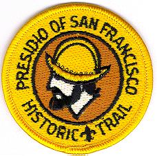
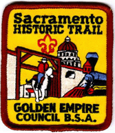
Hiking San Francisco Presidio Trails Hike around San Francisco Presidio trails. SF Presidio Page http://www.nps.gov/prsf/ The Presidio Historic Trail, sponsored by the San Francisco Bay Area Council, has a trail for Cub Packs and Boy Scout Troops. The Cub Scout Trail is about 3.5-miles as it starts from the Visitor Center, down to Fort Point and then around to Battery Chamberlin. The Boys Scout Trail is between 6.4 to 8.1 miles depending upon whether the troop hikes all across the Golden Gate Bridge and back. If you want a nearby place to camp, the Presidio has a group primitive site at Rob Hill near the WWII Memorial. Hike along the Sacramento historic trail. Patch awarded by Golden Empire Council. 1. Hike the trail as shown in the trail guide from Sutter's Fort to Old Sacramento and return (about 5 Mi). 2. Visit the State Capitol and the Californa State Railroad Museum. 3. A Visit to Sutter's Fort is recommended. Admission is charged (check for education prices) Link to website of Old Sacramento and Sacramento Museums Sacramento Historic Trail Document Detailed information on the hike.Map Of the Trail
1. Hike the trail as shown on the map, from the Railroad Museum in Old Sacramento to the 13th Street Station and take Light Rail to the Butterfield Station and return You can stay on the train until St. Rose of Lima Park on the K-Street Mall and walk west back to old Sacramento. Your hike should be 1 3/4 miles to the 13th Street Station and a half-mile back to Old Sacramento. Review city hiking rules in the Scout Handbook. 2. Visit the California State Railroad Museum. Sacramento Rail Historic Trail Document
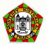
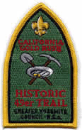
Details on the hike: Monterey Historic Hike and trip report on T494's outing: Monterey hike, sail and camping report Copy of the historical information sheet:Hike Scavenger QuestionsThe most interesting one deals with what you'll find at Monterey's Visitor Center. Almaden Quicksilver Historic Trail Gold Rush Historic 49'er Trail The California Gold Rush Historic 49'er Trail has been nationally approved by the B.S.A. for Tiger Cubs, Cub Scouts, Boy Scouts, Varsity Scouts, Venturers, and family campers. To earn the patch, visit Columbia SHP and at least two other museums in gold country to meet some of the requirements. http://www.bsa-gyc.org/camps/council_patches.htm#rush Doc file to print out requirements:Gold Rush Historic Trail Doc Nation's Trails Database of historic trails throughout the US http://nationstrails.com/trails/index.html 
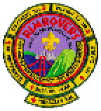
The Fages Historic Trail in the hills above Berkeley and El Cerrito commemorates and follows portions of the 1772 Rim of the Bay Hikes (Rim Rovers) The purpose of the RIM OF THE BAY patch program is to encourage hiking and to bring into the lives of our Scouts a "mountain top" experience. There are six Mountains that surround our area that you hike up. When you finish the first mountain you get a patch and a "rocker" with the name of the mountain. Rockers are awarded for each additional hike completed. All of these trips can be accomplished in a single day.http://www.sfbac.org/programs/hiking#rim Elevation Gain 2,517' Hike Length: 6.9 miles round trip (Peak Trail) Elevation Gain: 1,997' Jurisdiction: Department of Parks and Recreation, State of California Hike Length: 7 miles round trip Elevation: 3,849' Elevation Gain: 2,249' Jurisdiction: Department of Parks and Recreation, State of California Hike Length: 8.5 miles round trip Elevation: 2,571' Elevation Gain: 1,081' Jurisdiction: Point Reyes National Seashore Hike Length: 5 to 6 miles (depending on the trail). Elevation: 1,407' Elevation Gain: 1,367' Jurisdiction: Department of Parks and Recreation, State of California (located in Robert Louis Stevenson State Park) Hike Length: 11 miles (not recommended for Cub Scouts) Elevation: 4,343' Elevation Gain: 1,384' Administration: Superintendent, Pinnacles National Monument Hike Length: 9.5 kilometers (5.9 miles) round trip from the Visitor Center, across the High Peaks Trail and side trip through Bear Gulch Caves. This is the minimum hike to qualify for the patch. Longer trips are possible. See the discussion. A well-constructed, spectacular trail with some exposure. Cubs and younger Scouts should be closely supervised on the High Peaks Trail and in the caves. Flashlights for each hiker are required in the caves. Water must be carried as there is no water en route. Not recommended for summer as it gets extremely hot. Elevation Gain: 400 meters (1400 feet) Trail Trekkers Cub Scout Progressive Hike Award The Trail Trekkers Program offers a series of hikes which can be completed by Cub Scout age boys (from 6-11 years) and their families. website at San Francisco Bay Area Council http://www.sfbac.org/programs/hiking#Trail Trekkers Trail Trekkers Cub Scout Progressive Hike Award
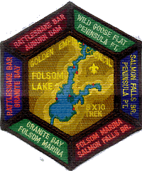
Folsom Lakes Progressive hikes The Folsom Lake Treks Folsom, California Click on link to the detailed page A Set of Six, Ten Mile Day Hikes Golden Empire Council, Boy Scouts of America return to top
return to topModified January 24, 2016 |
 segments.The troop has hiked the Big Basin to Waddell Beach portion.